Sign up here for our daily Globe Weather Forecast, which will arrive in your inbox bright and early each weekday morning.
After multiple days of hot temperatures and high humidity, Southern New England, including Boston, is set to see strong to severe weather move through the region this afternoon.
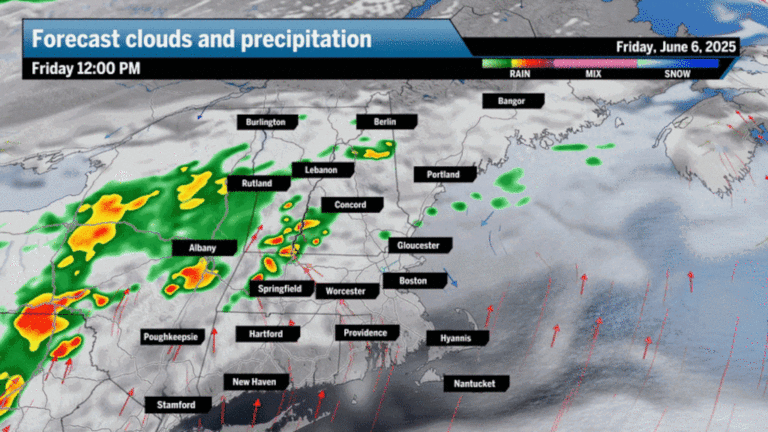
There is ample moisture in the atmosphere and storms will ride along a stalled frontal boundary from west to east starting between 2 and 3 p.m., eventually making their way to Boston by sunset.
The strongest storms may be concentrated between the Mass. Pike and just over the border into Southern Vermont and New Hampshire, but there’s enough energy in the atmosphere for storms to flare out more widely. Torrential rain and subsequent street flooding, strong wind gusts, and small hail are all possible with these storms.
These maps break down everything you need to know for the storms Friday afternoon and evening.
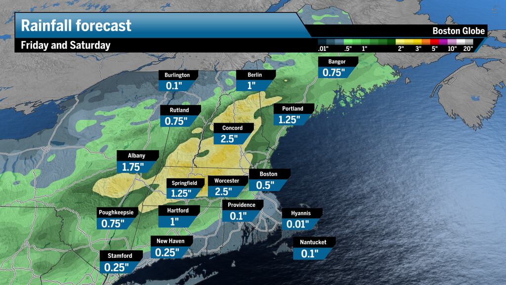
Numerous storms will tap into the atmosphere and release between 2 to 3 inches of rain in parts of Massachusetts and New Hampshire. This means torrential rainfall that can degrade visibility in a hurry and flood roadways, especially in city centers.

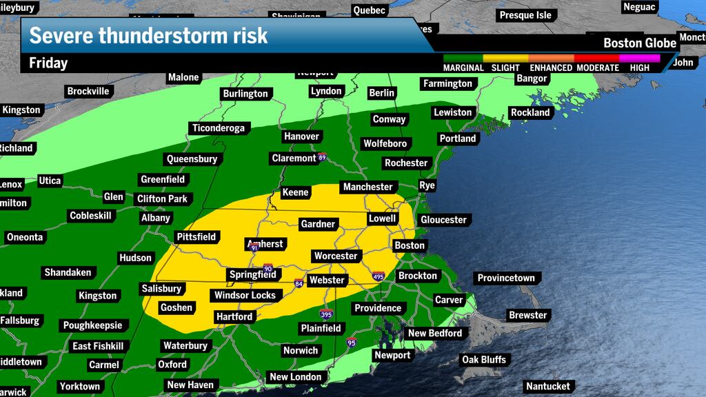
The strongest chance for severe thunderstorms exists from Greater Boston through the Berkshires — torrential rain, cloud-to-ground lightning, strong wind gusts, and small hail are all possible.
Here’s a slowed-down futurecast showing storms ramping up during the afternoon and sliding east toward Boston.

The reason for flood potential is the copious moisture in the atmosphere from a multiday stream of southerly air blanketing the region. It appears that Central and Western Mass., parts of New Hampshire, Rhode Island, and Connecticut are in for a dousing of rain.
Between Friday’s round of heavy rain and Saturday seeing widespread showers, some areas will see over 2 inches of rainfall, leading to a chance for flash flooding in some areas.
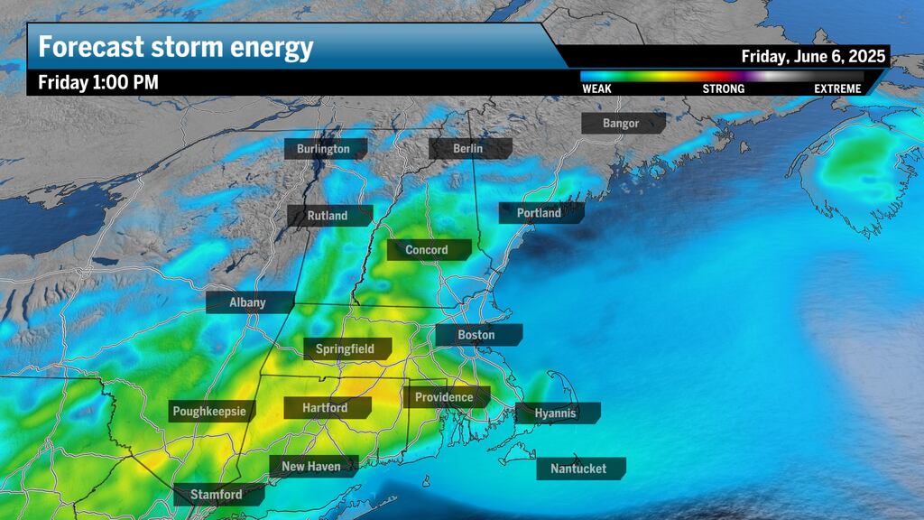
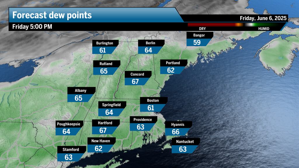
Dew points will remain in the 60s, an indicator that the atmosphere is holding quite a bit of moisture.


Comment count: